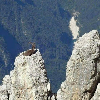
Gilgit-Baltistan is an autonomous region of 28,000 square kilometers located in the north of Pakistan, whose administrative affairs are run by Pakistan.
Gilgit-Baltistan is one of the most beautiful regions of the world, which is still shrouded in political expediency and personal grudges
Gilgit-Baltistan is basically a mountainous region where three mountain ranges, Karakoram, Hindu Kush and Himalaya meet, with thousands of mountains and beautiful valleys scattered in these mountains have their own stories.
There is a short section of Afghanistan's Wakhan Corridor "pan-handle" to the north-northwest of Gilgit-Baltistan. Just a quick hop across the Wakhan Corridor will take you to Tajikistan. The Xinjiang Uyghur Autonomous Region of China located to the region's rugged northeast. The states of Azad Jammu and Kashmir, which are administered by Pakistan, are bordered to the south by the Indian state of Jammu and Kashmir. Geographically, this area is undeveloped, far away, and ideal for the daring traveller!
why you travel to Gilgit baltistan?
The skinny: With its deep valleys, stunning mountains, glaciers, and lakes, this region is probably Pakistan's most diversified and gorgeous. Do it now because it is largely safe (2022).
The Gilgit-Baltistan Region of Pakistan is fascinating for the following reasons:
peoples:
The people of Gilgit-Baltistan are as beautiful as the regions here. Both the cold and the heat are fast at the heights. The same speed is also in the nature of the residents here. They are fighters by nature who keep getting confused by external signals. sometimes they consider playgroung as a battlefield. However, they are hospitable and polite.
The Fruits
75% of Pakistan's apricots are grown in Gilgit-Baltistan. Cherries, apples, plums, peaches, blueberries, mulberries, honey melons, and almonds are just a few of the delicious fruits that are farmed here. Many of them are shipped and sold as dried.
The Events
The annual three-day "Polo on the Roof of the World" festival, also known as the "Shandur Polo Festival of Pakistan," takes place during the second week of July and is one of the best events to go to because polo is the most well-liked sport in Gilgit-Baltistan.
Gilgit and Chitral's native teams, as well as teams from other regions, compete in the games in Skandur Top. It is the world's highest and probably most isolated polo field, located at 3,719 metres. The polo tournament also
Mountain Range
The highest mountain peaks in the world can all be found in Gilgit-Baltistan. The area has 50+ peaks above 7,000 metres and five "eight-thousanders" (peaks over 8,000 metres). This area is home to the second-highest peak on Earth, K2 (Mount Godwin-Austen), as well as the mountaineers' most-dreaded peak, Nanga Parbat.
The western Himalayas and the Karakoram are the principal mountain ranges. The Pamir Mountains are located farther north along Afghanistan's Wakhan Corridor and Tajikistan, while the Hindu Kush, which is home to Tirich Mir Peak at 7,708 m, is located to the northwest along Afghanistan's border. The Diamir District has Nanga Parbat (8,126 metres), whileK2 (8,611 m), Broad Peak (8,051 m), the Gasherbrums (7,932 - 8,080 m), and Masherbrum are more high summits (7,821 m).
Its Glaciers
In addition to the stunning snow-capped peaks that dot Gilgit-landscape, Baltistan's the area is renowned for its breathtaking glaciers. In fact, Gilgit-Baltistan is home of mountains and glaciers.
Most of the glaciers are located in the Karakorum Mountain range with almost 37% of the area being under glacial ice.
Walking on the Minapin Glacier in the Nagir Valley's Rakaposhi Base Camp
The second-longest glacier in the world, Siachen Glacier (76 km), is situated in territory claimed by India and follows a contentious border between Pakistan and India in the eastern Karakoram Mountain range. The glacier's elevation varies from 5,753 metres at its head at Indira Col to 3,620 metres at its base near the Chinese border. The Karakoram Mountain range is also home to the Biafo Glacier, the third-longest glacier in the world. More of the largest and longest glaciers in the world are spread out around the area, thus the list keeps going.These glaciers are massive freshwater reservoirs. In Pakistan, there are more than 60 large and small rivers that receive fresh water from melting glaciers. The glaciers' stunning beauty won't last forever because of climate change and global warming. According to some conservative projections, these glaciers will recede another 40–60 metres over the following ten years.
Lakes in the Glaciers
Looking for a glacier lake to swim in? The location is Pakistan! Over 2,000 glacial lakes are thought to exist in Gilgit-Baltistan, many of which have not yet been sstudied.
The eastern Skardu region contains Sheosar Lake, Satpara Tso Lake, Katzura Tso Lake, and Phoroq Tso Lake, some of the most magnificent high-altitude lakes. Additionally, the Hispar Glacier, which is 49 kilometres long, and Biafo Glacier, which is 67 kilometres long and 5,128 metres high, converge at the renowned Snow Lake. This led to the formation of the 100 km-long longest glaciated roadway in the world, which runs from Gilgit Baltistan's Askole in the Shigar Valley all the way to Hispar in the Nagar Valley.
In the Hunza Valley, at Attabad Lake
THE PERSIGLAS
Are petroglyphs and ancient rock art your thing? It is present in Gilgit-Baltistan, some of which may be reached relatively quickly via the renowned KaMore than 50,000 pieces of petroglyphs and rock inscriptions are thought to be scattered along the KKH in the Gilgit-Baltistan region, according to some geologists. On the 280 km path between Shatial in the south and the Hunza Valley in the north, the majority are concentrated at ten significant places.
Some of the earliest carvings date back to between 5000 BC and 1000 BC and were made by pilgrims, traders, invaders, and locals alike. The carvings, which depict humans, animals, and people hunting, were probably made with stone tools.

.jpeg)
.jpeg)
.jpeg)
.jpeg)
.jpeg)
.jpeg)
.jpeg)

.jpeg)
.jpeg)
.jpeg)
.jpeg)


.jpeg)

.jpeg)

0 Comments